Tahoe National Forest
Updated September 30, 2026 · 10 min read
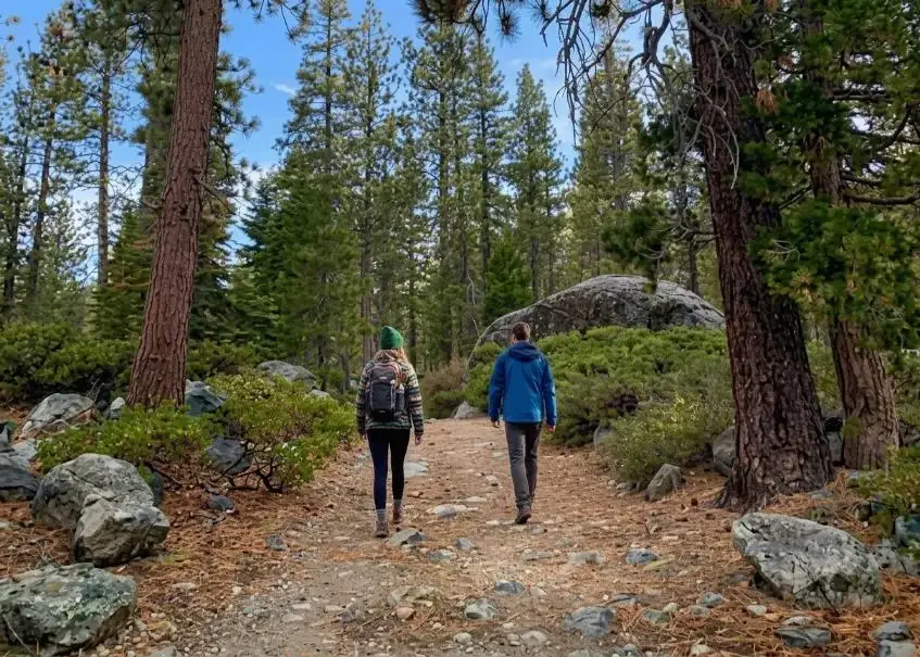
Tahoe National Forest: 850,000+ acres northwest of the lake. No entry fee; a campfire permit is needed for stoves, and Stage 1 fire rules run to Oct 31.
The short answer: Tahoe National Forest is a U.S. Forest Service forest of more than 850,000 acres in the northern Sierra Nevada, running from the foothills across the crest to the Nevada line, northwest and north of Lake Tahoe. There is no entrance fee. Day hiking needs no permit; you need a free California Campfire Permit for any stove or campfire outside a developed campground, and as of September 30, 2026 Stage 1 fire restrictions are in effect through October 31. The shoreline around the lake is not Tahoe National Forest: that is a separate Forest Service unit, the Lake Tahoe Basin Management Unit.
We manage vacation homes on the North and West Shores of Lake Tahoe, and the forest's closest trailheads and campgrounds are 10 to 30 minutes from our Tahoe City, Homewood, Kings Beach and Tahoe Vista homes. This guide covers what is in the forest, the permits and fire rules for 2026, the campgrounds nearest the North Shore, and how not to confuse it with the lake basin. Facts were checked against the Forest Service, Recreation.gov and CAL FIRE in September 2026.
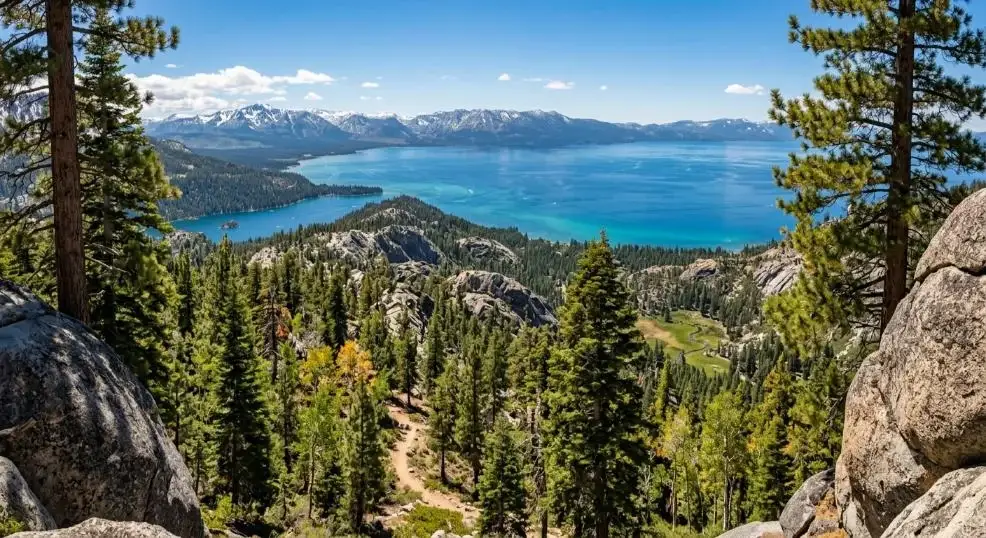
Where to stay near Tahoe National Forest
Search by datesIf your trip is about the lake as much as the forest, stay on the North or West Shore and drive to the trailheads. Tahoe City is closest to the Truckee River campgrounds and Granite Chief; Homewood is a few minutes farther down the West Shore; Kings Beach, Tahoe Vista and Carnelian Bay are 15–25 minutes from Truckee and the reservoirs north of it.
After a long hike, a home with a hot tub or a grill is the reward, and a whole house suits a group sharing gear and early starts; see homes for groups. Our homes don't accept pets, so if a dog is part of your hiking plan, a campground or pet-friendly lodging is the better fit.
Booking on our own site costs less than the same home on the booking apps: MG's nightly prices on Airbnb are set 28% higher than here (Vrbo 17%), and each home page shows the dollar saving for your dates (how booking direct works). Search your dates or browse all homes, and call (530) 317-0291 if you want a local's take on trail conditions before you go.
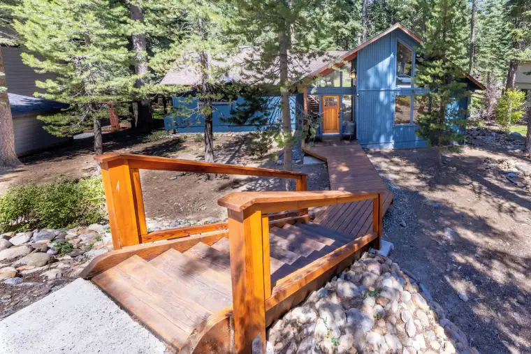
Grand Regency Retreat
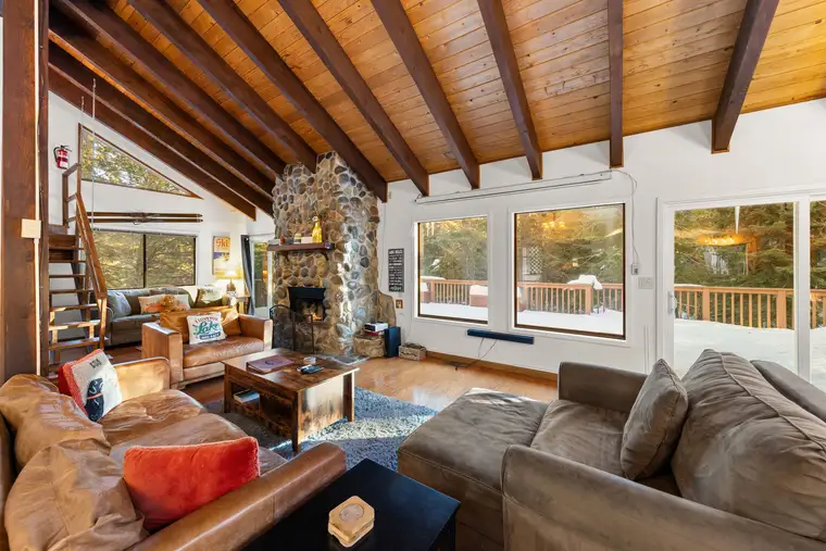
Sierra Woodlands Getaway
Tahoe Lake & Mountain Retreat
Book direct and pay less than for the same home on Airbnb: pick dates on any home to see the difference.
Tahoe National Forest quick facts
| Item | Details (as of September 2026) |
|---|---|
| Managed by | U.S. Forest Service (USDA), Pacific Southwest Region |
| Size | More than 850,000 acres of public land, intermixed with about 350,000 acres of private land |
| Supervisor's office | 631 Coyote Street, Nevada City, CA 95959; (530) 265-4531 |
| Nearest area to the North Shore | Truckee River corridor (Hwy 89 between Tahoe City and Truckee), Granite Chief Wilderness, Donner Summit, reservoirs north of Truckee |
| Entrance fee | None; campgrounds and some day-use sites charge |
| Wilderness | Granite Chief Wilderness (about 28,475 acres); no wilderness permit currently required |
| Fire restrictions | Stage 1 (order 17-26-15), June 26 to October 31, 2026; the forest was at Stage 2 from mid-August until September 28 |
| Campfire permit | Free California Campfire Permit required for stoves, lanterns and campfires outside developed sites |
| Camping reservations | Recreation.gov, plus some first-come sites |
| Official site | fs.usda.gov/r05/tahoe |
Where is Tahoe National Forest?
The Forest Service describes Tahoe National Forest as extending "from the foothills across the Sierra crest to the California-Nevada state line" in the northern Sierra. For a Lake Tahoe visitor, the useful parts are:
- The Truckee River corridor: Highway 89 between Tahoe City and Truckee, with three riverside campgrounds and the river bike path's northern reaches.
- Granite Chief Wilderness: the high country above Olympic Valley and Alpine Meadows, reached from Alpine Meadows Road about 15 minutes from Tahoe City.
- Donner Summit: I-80 west of Truckee, with the Pacific Crest Trail, Castle Peak and granite lakes.
- North of Truckee: Prosser, Boca and Stampede reservoirs, Sagehen Creek and Independence Lake.
- Farther out: the Sierra Buttes and Lakes Basin near Sierra City, the North Yuba River along Highway 49, and the American River canyons to the west, all an hour or more from the lake.
Truckee is the natural gateway town. We don't have homes in Truckee; our nearest homes are in Kings Beach, Tahoe Vista and Carnelian Bay, 15–25 minutes away, and in Tahoe City, which is closest to the Truckee River corridor and Granite Chief.
Tahoe National Forest vs the Lake Tahoe Basin Management Unit
This is the mix-up that trips up most trip planning. Both are Forest Service land, but they are separate units with separate offices, fire orders, maps and permits.
| Tahoe National Forest | Lake Tahoe Basin Management Unit (LTBMU) | |
|---|---|---|
| Where | North and northwest of the lake: Truckee, Donner Summit, Granite Chief, Sierra Buttes, Yuba and American river country | The Forest Service land inside the Lake Tahoe basin itself |
| Examples | Five Lakes, Loch Leven Lakes, Granite Flat campground, Stampede Reservoir | Pope and Baldwin beaches, William Kent campground, Tallac Historic Site, Desolation Wilderness (shared with Eldorado National Forest) |
| Wilderness permit | Granite Chief: not currently required | Desolation: required for every visit, day or overnight |
| Website | fs.usda.gov/r05/tahoe | fs.usda.gov/r05/laketahoebasin |
Fire restrictions can differ between the two units on the same day, so check the order for the unit you will actually be in. Beaches, Emerald Bay and the lakeshore are covered in our Lake Tahoe beaches guide and Emerald Bay guide; Emerald Bay itself is a California state park, not national forest.
Permits: what you need and what you don't
Day hiking
No permit is needed for day hikes in Tahoe National Forest, including in the Granite Chief Wilderness.
Backpacking and overnight trips
Per the Forest Service, wilderness permits are not presently required for day or overnight use in the Granite Chief Wilderness. Special rules still apply: camping, campfires and stove use are prohibited within 600 feet of any lake in the Five Lakes basin, and camping is prohibited within 600 feet of wilderness lakes generally. Check the Granite Chief Wilderness page before you go, as rules can change.
If your route crosses into Desolation Wilderness (south of the lake basin, managed by LTBMU and Eldorado National Forest), you need a Desolation permit for every visit; overnight permits are quota-limited and reserved on Recreation.gov, and bear canisters are required for overnight stays.
California Campfire Permit
A free California Campfire Permit is required to use a campfire, a portable stove or a lantern outside a developed campground. Get it online from CAL FIRE's Ready for Wildfire permits page or at a Forest Service office. The permit doesn't override fire restrictions; it is what allows you to use a pressurized stove under Stage 1.
OHV
Off-highway vehicles need a California OHV "green" or "red" sticker or valid out-of-state registration, and may only use routes shown as open on the forest's free Motor Vehicle Use Map, available from ranger district offices.
Fire restrictions in 2026
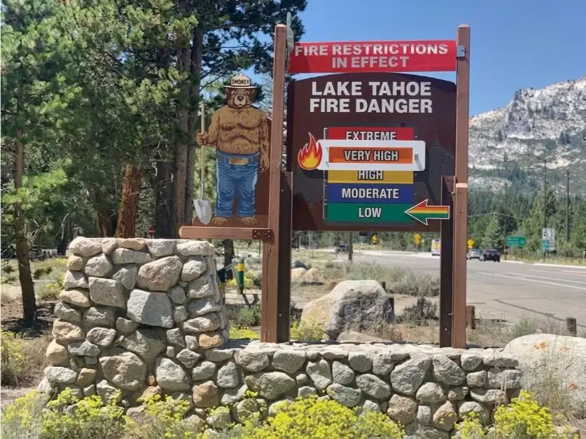
Tahoe National Forest entered Stage 1 fire restrictions on June 26, 2026 (order 17-26-15), moved to Stage 2 in mid-August, and lowered back to Stage 1 on September 28 after cooler weather and higher fuel moisture. The Stage 1 order runs through October 31, 2026. Under Stage 1:
- Prohibited: building or using a wood or charcoal fire anywhere except provided fire rings and charcoal grills at the developed recreation sites listed in the order.
- Prohibited: smoking outside an enclosed vehicle or building, a developed recreation site, or a cleared area at least three feet across.
- Prohibited: operating an internal combustion engine off paved, gravel or dirt forest roads, except in the Prosser Pits OHV Area and on water.
- Allowed with a California Campfire Permit: portable stoves, lanterns and campfire devices burning gas, kerosene or liquid fuel with a shut-off valve, in an area cleared of flammable material.
Penalties under the order: a fine of up to $5,000 for an individual or $10,000 for an organization, up to six months in prison, or both. Restrictions change with the weather; check the forest's alerts page before every trip, not just once a season.
Hikes near the North Shore
Five Lakes Trail (Granite Chief Wilderness)
The easiest way into Granite Chief. The trailhead is on Alpine Meadows Road, about 15 minutes from Tahoe City and a little more from our Homewood homes. The trail climbs steadily on exposed granite for about 2 miles to a basin of small lakes that are good for a swim or picnic. Start early in summer: the climb is hot and the roadside parking fills. Remember the 600-foot rule around the lakes if you stay overnight.
Loch Leven Lakes
One of the forest's most popular hikes, off I-80 near Big Bend, roughly 20–25 minutes west of Truckee. The trail climbs over granite slabs to a chain of three lakes: roughly 2.5 miles one way to the lower lake and about a mile more to the upper lake, so plan on 5 to 7.5 miles round trip depending on how far you go.
Donner Summit and Castle Peak
The Pacific Crest Trail crosses I-80 at Donner Summit, and the Castle Peak area just north of the freeway is a classic summer wildflower hike and a winter snowshoe destination. In winter, roadside parking at Donner Summit is limited and enforced; use designated Sno-Parks.
Sierra Buttes Fire Lookout (a day trip)
The forest's showpiece hike is near Sierra City, roughly 1.5 to 2 hours' drive from the North Shore. From Packer Saddle it is about 5 miles round trip with roughly 1,800 feet of gain, finishing on steel stairs bolted to the rock up to the lookout at about 8,587 feet. It is a full day from the North Shore, and the stairs are not for anyone uneasy with heights.
For hikes inside the lake basin, see our East Shore Trail guide and things to do in Lake Tahoe.
Camping near Truckee and North Lake Tahoe
Developed campgrounds
The closest Tahoe National Forest campgrounds to the North Shore line the Truckee River on Highway 89 between Tahoe City and Truckee: Granite Flat, Goose Meadows and Silver Creek. Recreation.gov describes Granite Flat as sitting between the river and Highway 89, about a mile from Truckee, with 75 sites (including walk-in tent sites), drinking water, and a limit of two leashed dogs per single site. North of Truckee, campgrounds at Prosser, Boca and Stampede reservoirs suit families with boats and kayaks.
Book on Recreation.gov; most sites are reservable, and some campgrounds keep first-come sites. Nightly fees are set per campground and change year to year, so check the listing. Most higher campgrounds close for the season in fall.
Inside the lake basin (LTBMU, not Tahoe National Forest), William Kent campground near Tahoe City and the California state park campgrounds on the West Shore are the other close options.
Dispersed camping
Camping outside developed campgrounds is allowed in much of the forest, but you are on your own: no water, no toilets, and fires only as the current restriction stage allows (under Stage 1, no wood fires outside developed sites). Camp well away from lakes and streams, pack out everything, and ask the Truckee Ranger District about areas that are closed or day-use-only before you go.
Fishing and water
- Truckee River: between Tahoe City and Truckee along Highway 89, with easy roadside access. In summer the stretch below Tahoe City is also the rafting run; see our Truckee River rafting guide.
- Reservoirs north of Truckee: Prosser, Boca and Stampede for trout (and kokanee at Stampede) and boating.
- Independence Lake: a Nature Conservancy preserve protecting native Lahontan cutthroat trout. No outside boats, float tubes or paddlecraft are allowed (the Conservancy provides some watercraft for public use), Lahontan cutthroat are catch-and-release only, and anglers must use artificial lures with barbless hooks. The fishing season runs from the Saturday before Memorial Day through September 30. See the Nature Conservancy's Independence Lake page.
A California fishing license is required for anglers 16 and older; check current California Department of Fish and Wildlife regulations for each water.
Know before you go
- Check the fire order for the unit you'll be in (Tahoe National Forest or LTBMU) the day before, not just once a season.
- Carry your Campfire Permit if you'll use a stove, even for a lunch stop.
- Bring more water than you think. Trails like Five Lakes are exposed granite at 7,000+ feet; sun and altitude dehydrate fast.
- Watch the afternoon sky. Summer thunderstorms build over the crest most afternoons; be off exposed ridges and summits by early afternoon.
- Store food properly. Black bears are common around Tahoe and Truckee. Use campground bear boxes, never leave food in a car at a trailhead overnight, and use a canister where required.
- Cell coverage is patchy away from I-80 and Highway 89. Download maps before you leave and tell someone your route.
- Pack it out. There are no trash cans at most trailheads.
Best time to visit
| Season | Best for | Watch out for |
|---|---|---|
| Summer (July–September) | High-country hiking, lakes, camping, fishing | Fire restrictions, crowded trailheads on weekends, afternoon thunderstorms |
| Fall (October–November) | Quiet trails, fall color, fishing | Cold nights, campground closures, early snow at elevation |
| Winter (December–March) | Snowshoeing and cross-country skiing at Donner Summit | Road closures, chain controls, avalanche terrain; Sno-Park permits for parking |
| Spring (April–June) | Rivers running high, lower-elevation hikes | High-country trails still under snow into June some years |
More on seasons in our best time to visit Lake Tahoe and Lake Tahoe summer guides.
A sample day from the North Shore
- 7:00 am: leave Tahoe City for the Five Lakes trailhead on Alpine Meadows Road (about 15 minutes).
- 7:30–11:00 am: hike to the lakes, swim, and hike out before the midday heat.
- Noon: lunch in Tahoe City, then an afternoon float or bike ride along the Truckee River.
- Evening: dinner on the deck; no campfire needed.
Questions
Where is Tahoe National Forest?
In the northern Sierra Nevada, northwest and north of Lake Tahoe. It runs from the Sierra foothills east across the crest to the California-Nevada line, taking in Donner Summit, the Truckee River corridor between Tahoe City and Truckee, the reservoirs north of Truckee, the Granite Chief Wilderness above Olympic Valley and the Sierra Buttes. The supervisor's office is at 631 Coyote Street in Nevada City. The land right around the lake is a separate unit, the Lake Tahoe Basin Management Unit.
Is Tahoe National Forest the same as Lake Tahoe Basin Management Unit?
No. Both are run by the U.S. Forest Service, but they are separate units with their own offices, orders and permits. Tahoe National Forest covers the forest north and west of the lake. The Lake Tahoe Basin Management Unit manages the Forest Service land inside the lake basin itself, including beaches like Pope and Baldwin and, together with the Eldorado National Forest, the Desolation Wilderness.
Is there a Tahoe National Park?
No. There is no national park at Lake Tahoe. The public land around the lake is a mix of national forest (Tahoe National Forest and the Lake Tahoe Basin Management Unit), California and Nevada state parks such as Emerald Bay and Sand Harbor, and local beaches and parks.
Do I need a permit to backpack in Tahoe National Forest?
For the Granite Chief Wilderness, no wilderness permit is currently required for day or overnight trips. You do need a free California Campfire Permit to use a camp stove, lantern or campfire, and camping, campfires and stoves are banned within 600 feet of the lakes in the Five Lakes basin. Desolation Wilderness, south of Tahoe National Forest, is different: it needs a permit for every visit, day or overnight, with a quota and fee for overnight trips.
Do I need a campfire permit in Tahoe National Forest?
Yes, if you plan to use a campfire, a portable stove or a lantern outside a developed campground. The California Campfire Permit is free and available online from CAL FIRE's Ready for Wildfire site or at Forest Service offices. During fire restrictions, the permit lets you use pressurized gas or liquid-fuel stoves with a shut-off valve in a cleared area; wood and charcoal fires are limited to fire rings and grills at listed recreation sites.
Are there fire restrictions in Tahoe National Forest right now?
As of September 30, 2026, yes: Stage 1. The forest moved from Stage 2 back to Stage 1 on September 28, and the Stage 1 order (17-26-15) runs through October 31, 2026. Campfires are allowed only in provided fire rings and grills at listed developed sites, smoking is limited, and engines are restricted off roads except at Prosser Pits OHV area. Violations can bring a fine of up to $5,000 for individuals.
Is there a fee to enter Tahoe National Forest?
No. There is no entrance fee for the forest. Developed campgrounds charge nightly fees, typically booked on Recreation.gov, and some day-use sites have their own fees. Check the specific site on Recreation.gov or with the ranger district.